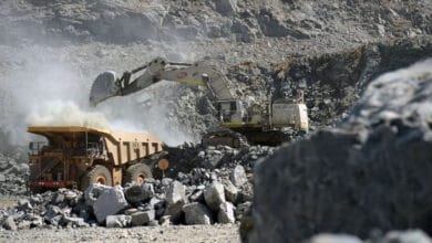
Mining operators are entering a new era of environmental intelligence. The convergence of satellite connectivity, next generation Earth observation, and radar satellites together with ground-based sensors and AI-driven analytics is aiming to transform what is possible in risk monitoring and mitigation.
This shift was the focus of Insight Terra’s inaugural Data Dialogues webinar, which brought together industry experts from Viasat, Synspective, and Insight Terra to explore how emerging space-based technologies are bridging data gaps, cutting monitoring costs, and driving stronger ESG outcomes across the mining sector and beyond.
Moderated by industry veteran Dave Morris, the discussion highlighted that satellite systems – once scarce and expensive – have become more reliable and accessible, opening the door to real-time geo-monitoring and preventative action.

“We work at the intersection of data and environmental resilience,” said Alastair Bovim, CEO and co-founder of data- and AI-driven environmental risk platform, Insight Terra. “By fusing satellite intelligence with live ground data, we’re creating a system that not only senses but reacts in real time, enabling engineers to act before risk becomes failure.” According to Bovim, these technologies must function as a unified ecosystem, much like a human body, to drive targeted action. He likens radar satellite data to the eyes, communications satellites to the nervous system, and Insight Terra’s analytics and action triggers to the brain, working together to sense, transmit, and respond in real time.
Connectivity, data and action: Closing the risk loop
The panel identified three major challenges for remote monitoring in mining:
- Reliable communications and connectivity – the ability to transmit and gather information, especially in remote locations;
- Access to quality data – what can be monitored, especially in remote locations; and
- The ability to turn that data into actionable insights and associated actions
The webinar’s audience of mine engineers, leadership and consultants noted that while all three where active challenges, over 50% struggled most with using their data and spurring action.
Jacques West, Director of Partner Growth Programs at Viasat, said connectivity is the foundation of environmental intelligence. “For many critical sites – mines, energy facilities, or dams for example – the biggest challenge isn’t collecting data, it’s getting that data off-site fast enough to act on it. Satellite networks can close that gap, using open standards and low-power IoT to deliver reliable, real-time information from even the most remote corners of the world. Connectivity is no longer the barrier, it’s the bridge between sensing and understanding, between observation and prevention.”
As these next-generation networks expand, data collected from even the most remote sites will be available in the cloud in more quickly. Each instrument – from piezometers and inclinometers to weather stations – becomes part of the same secure ecosystem, streaming data into Insight Terra’s AWS-cloud based platform for analysis and early warning.
The eyes in the sky
Keizo Fujiwara, Executive Officer of Synspective, explained that radar satellites – and especially InSAR or Interferometric Synthetic Aperture Radar – allow them to detect ground movement down to the millimetre, even when it’s invisible to the human eye. “Our StriX radar constellation can observe through cloud, dust and darkness, making it ideally suited to challenging mining environments. As we expand to a 30-satellite constellation, revisit rates will increase, making it possible to deliver satellite insights – along with actionable analysis – to customers in less than one hour,” Fujiwara explained. “This capability transforms how operators monitor tailings dams, open pits, and infrastructure, turning space data into a vital, near real-time layer of ground truth.”
By pairing continuous orbital data with minute-by-minute sensor readings, mining operators can build digital twins of their critical assets, from tailings storage facilities to water systems. This connected monitoring ecosystem transforms monitoring from a static compliance exercise into a proactive, predictive process and helps mining operators see the full picture – from orbit to site – and make faster, more confident decisions.”
A smarter path to ESG
The speakers agreed that this technology convergence marks a turning point for sustainability and governance in mining. Real-time visibility into environmental performance makes compliance auditable and transparent. This is essential as global frameworks like the Global Industry Standard for Tailings Management (GISTM) raise expectations for continuous monitoring and reporting.
“Technology like this doesn’t replace human judgment, it amplifies it,” Bovim emphasised. “Real resilience comes from collaboration between engineers, operators, and technologists. By creating systems that sense, learn, and act, we can move from reacting to instability to anticipating it – protecting both people and the planet.”