Pelangio Exploration commences UAV magnetics survey on Obuasi Project

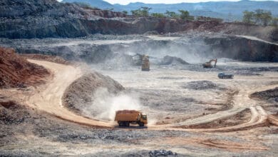
Pelangio Exploration Inc. is pleased to announce that a high-resolution UAV airborne magnetics survey has commenced on its Obuasi property, adjacent to the giant high-grade Obuasi Mine owned by AngloGold Ashanti PLC. The survey is expected to take 3-4 weeks to complete.
“The high-resolution airborne drone magnetics survey covers one of the most prospective areas of our Obuasi property situated on strike with the renowned Obuasi Mine. The survey is being conducted in collaboration with TuNya Mineral Resources Ltd. as part of their earn-in on the southern Tarkwaian portion of our property. This survey is expected to yield critical data that will enhance our targeting of Obuasi-style gold mineralization on our property. We are eager to review the survey results and explore the targets it identifies for further evaluation and follow-up,” said Ingrid Hibbard, President and CEO.
Pelangio’s 284 square kilometer Obuasi property is located in Ghana, Africa’s largest gold producer. It is strategically situated in the Ashanti Gold Belt, West Africa’s largest gold belt and globally recognized for its rich, high-grade gold deposits with centuries of successful gold mining. Our Obuasi property is adjacent to Anglo-Gold’s Ashanti’s high-grade Obuasi Mine with gold endowment exceeding sixty million ounces.

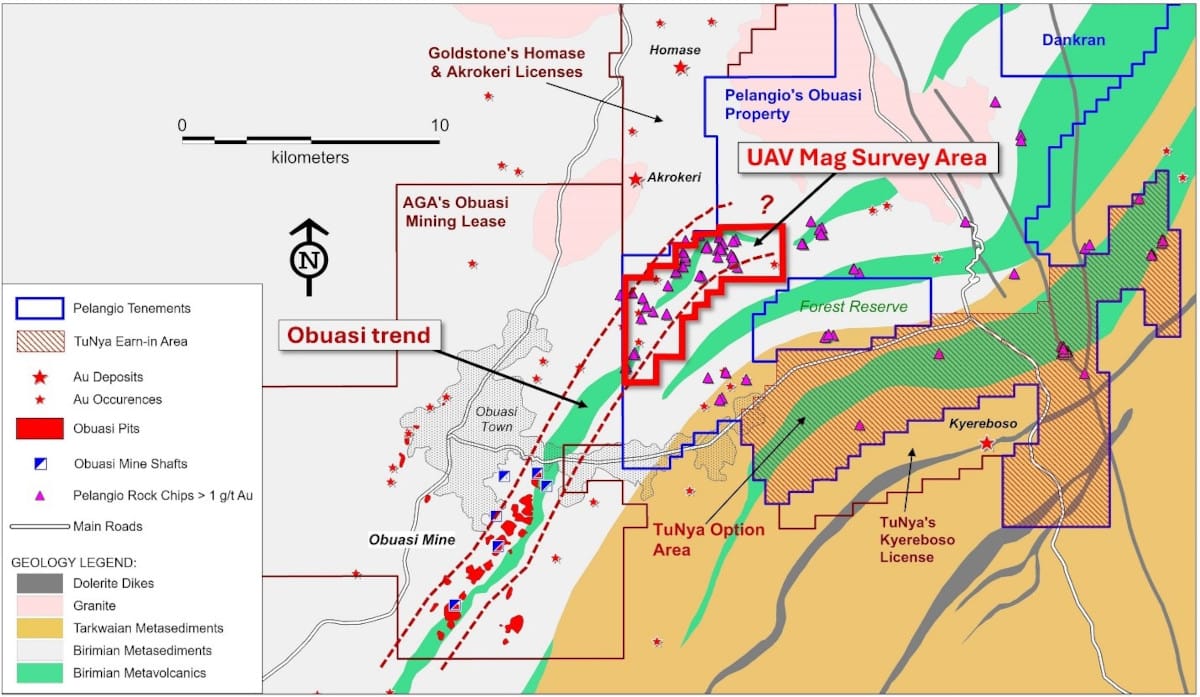
TuNya are conducting a US$250,000 technical study of Pelangio’s Obuasi property as partial fulfillment of their earn-in on the southern Tarkwaian portion of the Obuasi property. This work commenced in October of 2023 with a desk top review of Pelangio’s considerable exploration datasets plus a start on detailed field mapping over the western half of the property. Field mapping was completed in May of 2024 and a report was issued with recommendations that included the flying of a high-resolution UAV (drone) airborne magnetics survey over the principal area of interest identified in the western margin of the property covering the interpreted strike extension of the Obuasi mineralized trend. Here, a significant concentration of Pelangio’s historical anomalous rock chip samples > 1 g/t Au occurs with much of the 8-kilometer long target untested by trenching and drilling. Refer to Figure 1.
Following the flying of the magnetic survey, the data will be processed, imaged and geologically plus structurally interpreted with recommendations for follow up to be funded by TuNya, likely to include a program of pitting and trenching to test the most favourable targets.
Survey details
The drone (UAV) airborne magnetics survey being flown at Obuasi will be conducted by SEMS Exploration of Ghana. The survey will be flown with a GEMS Systems AIRBIRD magnetometer suspended from a Matrice 300 RTK drone along 50-meter spaced lines with a total of 400 line-kilometers covering an area of approximately 20 square kilometers. The survey is expected to take three weeks, depending on the weather. SEMS inhouse geophysicist will process and image the survey data and provide a report plus GIS imagery to Pelangio within ten days of completion of the survey.